How Do Meteorologists Predict the Weather So Accurately?
Have you ever planned the perfect weekend barbecue, checked your phone's weather app, saw a reassuring sun icon, only to have a sudden downpour ruin your burgers? We have all been there, friends. It is easy to poke fun at the local weather forecaster when they get it wrong. In fact, complaining about the weather person is practically a global pastime. But if we step back and look at the bigger picture, the reality is absolutely mind-blowing. Modern weather forecasting is one of the greatest scientific and technological achievements in human history. The fact that we can look at a screen and know, with incredible accuracy, what the sky will do three, five, or even seven days from now is nothing short of a daily miracle.
Think about what meteorologists are actually trying to do. They are trying to predict the behavior of a chaotic, invisible, fluid envelope—our atmosphere—that wraps around a spinning planet, heated unevenly by a giant ball of nuclear fusion in space, while interacting with massive oceans, towering mountain ranges, and changing landscapes. It is a physics problem of gargantuan proportions. Yet, today’s five-day forecast is as accurate as a three-day forecast was just twenty years ago. So, how do they do it? How do we get such precise predictions? Grab a warm cup of coffee, friends, because we are going to dive deep into the fascinating science, the mind-boggling supercomputers, and the human expertise that make weather forecasting so incredibly accurate today.
The Invisible Net: How We Capture the Atmosphere’s Data
Before we can predict the future, we have to understand the present. In meteorology, this is known as initialization.You cannot tell where a storm is going if you do not know exactly where it is right now, how fast it is moving, and how warm the air around it is. To capture this snapshot of the atmosphere, we have built a massive, interconnected global observation network. We are talking about thousands of instruments working simultaneously across the globe, constantly taking the pulse of the planet.
1. Eyes in the Sky: Weather Satellites
High above the Earth, a fleet of weather satellites keeps a constant watch on our weather patterns. There are two main types of satellites we rely on. First, we have geostationary satellites, like the GOES series operated by NOAA. These orbit at the exact speed of the Earth's rotation, meaning they hover over the same spot constantly. They give us those beautiful, real-time loops of hurricanes spinning in the ocean or clouds sweeping across continents. Second, we have polar-orbiting satellites. These fly much closer to Earth, looping from pole to pole as the Earth spins beneath them. They scan the entire planet twice a day, providing incredibly detailed data on atmospheric temperature, moisture, and wind speeds at various altitudes.
2. The Ground Troops: Weather Radar and Surface Stations
Down here on the surface, we have Doppler radar systems. If you have ever watched the weather on TV and seen those colorful sweeps of green, yellow, and red, you are looking at radar data. Doppler radar works by sending out radio waves and measuring how they bounce off water droplets or ice crystals in the air. This tells us not only where it is raining or snowing, but also how fast those particles are moving toward or away from the radar. This is crucial for detecting the rotation that can lead to tornadoes. Supporting this are tens of thousands of automated surface weather stations located at airports, schools, and research outposts, constantly measuring temperature, humidity, pressure, wind speed, and rainfall.
3. The High-Altitude Explorers: Weather Balloons
This is one of the coolest, most old-school parts of the process that still happens every single day. Twice a day, at exactly the same time (00:00 and 12:00 UTC), meteorologists at nearly 900 locations around the world release weather balloons. These balloons carry a small, expendable instrument package called a radiosonde. As the balloon climbs up to 100,000 feet into the stratosphere, it transmits real-time data on temperature, humidity, and air pressure. By tracking the balloon's movement, we also get precise wind speed and direction measurements at different layers of the sky. Eventually, the balloon pops, a small parachute deploys, and the instrument package drifts back to Earth. This simultaneous global launch gives us a three-dimensional snapshot of the atmosphere twice a day.
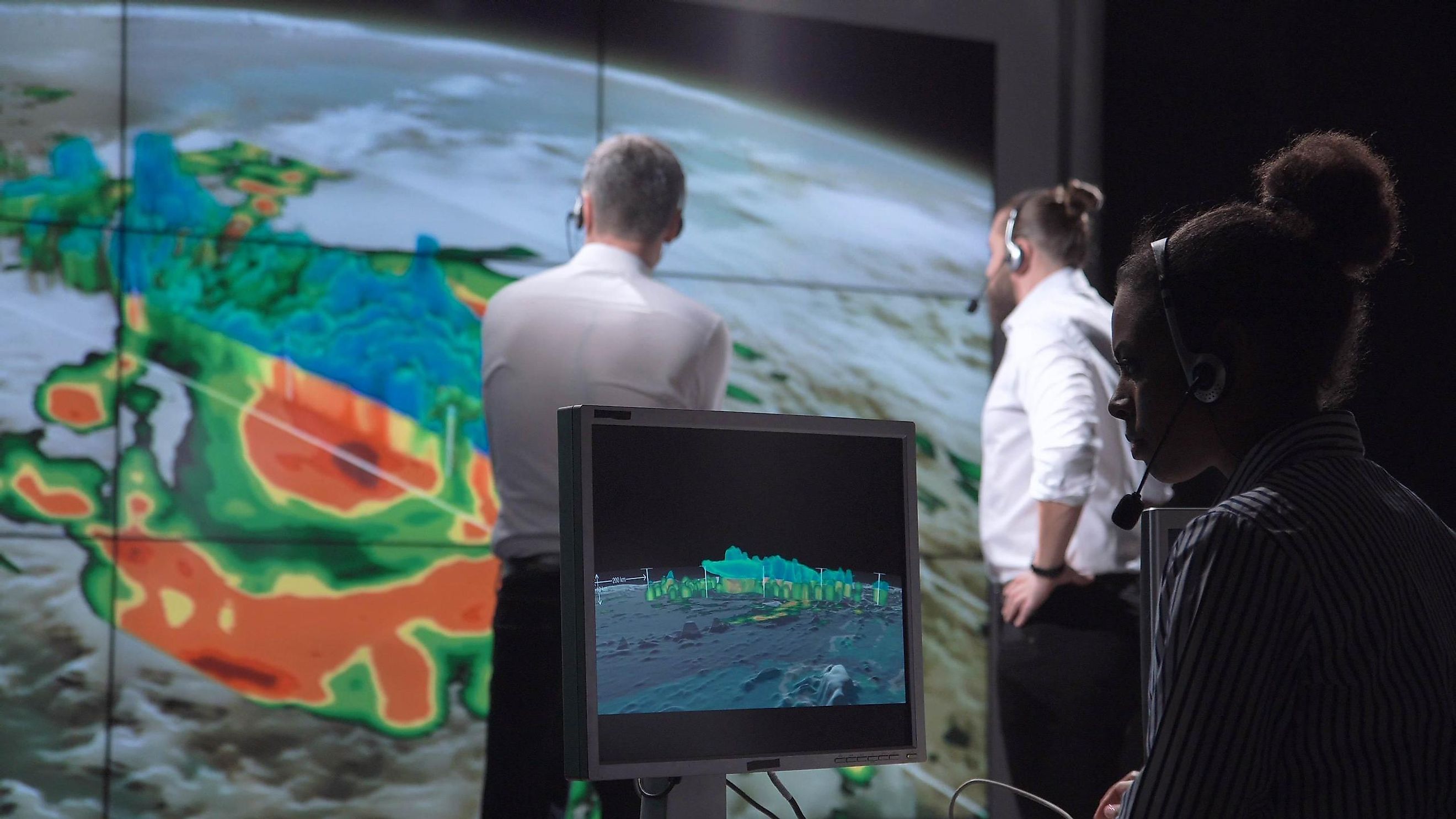
The Brains of the Operation: Numerical Weather Prediction
Once we have gathered all this raw data from satellites, radar, stations, and balloons, what do we do with it? The sheer volume of data is overwhelming. We are talking about petabytes of information. This is where Numerical Weather Prediction (NWP) comes in. This is the heart of modern meteorology, and it relies on some of the most powerful supercomputers on Earth.
To understand NWP, we have to look at the atmosphere through the lens of physics. The atmosphere behaves according to the laws of fluid dynamics and thermodynamics. We have equations—like the Navier-Stokes equations—that describe how air moves, how pressure changes, how heat is transferred, and how water changes from vapor to liquid to ice. The problem is, these equations are incredibly complex. You cannot just plug in numbers and get a simple algebraic answer. They can only be solved using numerical approximations, which require billions of calculations per second.
To do this, the supercomputers divide the Earth's atmosphere into a three-dimensional grid. Imagine the entire planet wrapped in a giant, invisible cage of boxes. Each box represents a specific volume of air. The supercomputer takes the initial data we gathered and assigns values for temperature, pressure, wind, and humidity to each box. Then, it runs the physics equations to calculate how the air in each box will interact with its neighboring boxes over a short time step—say, ten minutes into the future. Once it calculates that new state, it uses those results to calculate the next ten minutes, and the next, projecting forward hours, days, or even weeks. The smaller the grid boxes (higher resolution), the more accurate the forecast, but the more computing power we need.
Dealing with Chaos: The Butterfly Effect and Ensemble Modeling
Even with the most powerful supercomputers, we run into a fundamental limit of nature: chaos. You might have heard of the "butterfly effect," a concept popularized by meteorologist Edward Lorenz in the 1960s. He discovered that tiny, almost imperceptible differences in the initial conditions of a weather model could lead to wildly different weather outcomes a week down the line. A butterfly flapping its wings in Brazil could, in theory, set off a chain reaction that causes a tornado in Texas weeks later.
Because we can never measure the state of the atmosphere with 100% perfection—there will always be tiny gaps in our data—our initial starting point for the computer models will always be slightly off. If we run just one model, that tiny error will grow over time, making a 10-day forecast highly unreliable. So, how do we solve this, friends? We use a brilliant technique called ensemble forecasting.
Instead of running a single forecast model once, we run it many times (often 30 to 50 times) simultaneously. But here is the trick: for each run, we tweak the initial data just a tiny bit, representing the uncertainty in our measurements. If all 50 runs of the model show a storm hitting a specific city in five days, we can have high confidence in that forecast. If half of the runs show the storm hitting, and the other half show it missing completely, we know the forecast is highly uncertain. This is why forecasters talk about probabilities and confidence levels. It is not that they do not know what they are doing; they are accurately communicating the inherent uncertainty of a chaotic system.
The Human Touch: Why We Still Need Meteorologists
With all these satellites, radars, and supercomputers, you might wonder why we still need human meteorologists. Why not just let the computer print out the forecast and call it a day? Well, as smart as computers are, they lack intuition, local experience, and the ability to recognize when a model is going off the rails.
Human meteorologists are the translators. They look at multiple different computer models—like the American GFS model and the European ECMWF model—which often disagree. A seasoned meteorologist knows the strengths and weaknesses of each model. They know that a certain model might have a bias toward making storms too wet, or that another model struggles with how mountains affect wind patterns in their specific region. They can look at real-time radar and satellite loops, realize the computer model missed a key development, and adjust the forecast manually. Furthermore, they play a critical role in communication. A computer can tell you it is going to rain, but a human meteorologist can tell you what that rain means for your morning commute, your local river levels, and your safety.
Key Points of Modern Weather Forecasting
- Data Initialization: Gathering real-time data from satellites, weather balloons, radar, and surface stations to create a snapshot of the atmosphere.
- Numerical Weather Prediction (NWP): Using supercomputers to solve complex physics equations that simulate atmospheric behavior.
- Grid Resolution: Dividing the atmosphere into 3D grid cells; smaller cells lead to more detailed and accurate forecasts.
- Ensemble Forecasting: Running models dozens of times with slight variations to measure uncertainty and calculate probabilities.
- The Human Factor: Meteorologists using local knowledge and experience to interpret, correct, and communicate model outputs.
Questions and Answers
Q1: Why does it still rain when the forecast says there is only a 10% chance of rain?
This is one of the most common misunderstandings in meteorology! When you see a "10% chance of rain" (Probability of Precipitation, or Po P), it does not mean there is a 10% chance of rain falling from the sky somewhere in your state. The official formula for Po P is: Probability of rain occurring somewhere in the forecast area multiplied by the percentage of the area that will receive rain. So, if a meteorologist is 100% sure that a tiny shower will hit exactly 10% of the city, the Po P is 10%. Alternatively, if they are only 50% sure that a rain band will sweep across 20% of the area, the Po P is also 10%. If it rains on you during a 10% day, you just happened to be in the lucky (or unlucky!) small area where the rain developed.
Q2: How far in advance can we reliably predict the weather?
Generally speaking, modern weather forecasts are highly reliable up to about 5 to 7 days. Beyond 7 days, the chaotic nature of the atmosphere (the butterfly effect) begins to dominate, and the accuracy drops off significantly. A 3-day forecast today is incredibly accurate, usually correct about 97% of the time. By day 5, accuracy is around 90%. By day 10, the forecast is closer to a historical average than a precise prediction, though we can still identify broad trends (like a coming cold snap or wet pattern) even if we cannot pin down the exact timing or rainfall amounts.
Q3: What role does Artificial Intelligence (AI) play in modern weather forecasting?
AI is the new frontier in meteorology, and it is changing the game rapidly. Traditionally, NWP models rely on solving physics equations, which is computationally heavy and slow. Recently, tech companies and meteorological agencies have trained AI models on decades of historical weather data. Instead of calculating the physics step-by-step, these AI models recognize patterns in how weather systems move and evolve. They can generate highly accurate global forecasts in seconds rather than hours, using a fraction of the energy. While they do not replace physics-based models yet, they are becoming incredibly powerful tools for forecasters.
Q4: Why are winter snowstorms so much harder to predict than summer heatwaves?
Winter storms are incredibly sensitive to tiny temperature variations. The difference between a massive, crippling blizzard and a cold, slushy rain is often just one or two degrees Fahrenheit throughout the lower atmosphere. If a layer of warm air just a few hundred feet thick sneaks into the storm system, snow melts into sleet or rain, completely changing the accumulation totals. Additionally, winter storms often have sharp boundaries; a track shift of just 30 miles can mean the difference between a foot of snow and nothing at all. Heatwaves, on the other hand, are driven by massive, slow-moving high-pressure systems that cover huge areas and change slowly, making them much easier to predict days in advance.
Conclusion: Appreciating the Science in the Sky
So, friends, the next time you check your phone and see that a storm is predicted to start at exactly 3:00 PM—and it actually does—take a moment to appreciate the sheer scale of human ingenuity behind that notification. From the weather balloon rising silently into the freezing stratosphere, to the supercomputer humming in a cooled server room processing billions of calculations, to the local meteorologist translating those numbers into plain English, weather forecasting is a triumph of science. It keeps us safe, helps our farmers grow food, protects our infrastructure, and yes, helps us plan our weekend plans. The atmosphere may be chaotic, but our ability to read its secrets gets better every single day.
Post a Comment for "How Do Meteorologists Predict the Weather So Accurately?"
Post a Comment