Christmas Travel Weather May Be Unpredictable Across Parts of the U.S. Starting Friday: A Sneak Peek
Christmas Travel Weather Outlook
As the Christmas holiday travel season begins, travelers across the United States can expect a mix of weather conditions that may impact their journeys. The forecast for the upcoming days shows a variety of challenges, particularly on the East Coast and in certain regions of the West.
Friday's Weather Conditions
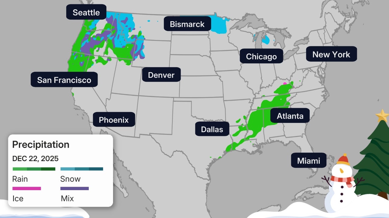
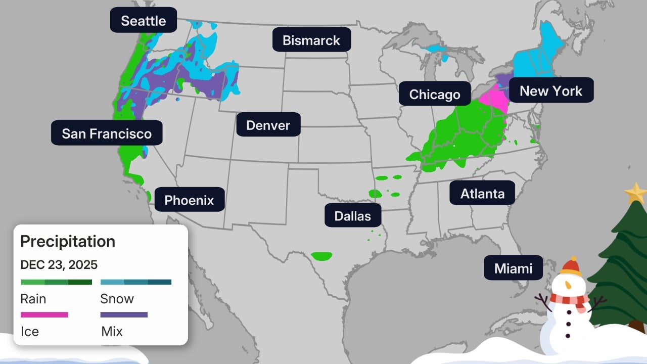
Friday will bring unsettled weather to both coasts, with strong winds in between. In the West, the heaviest rain is expected in Northern California, stretching as far south as the Bay Area-Sacramento Interstate 80 corridor. Local flash flooding is possible, especially in areas recently affected by wildfires. Light showers are anticipated in the Pacific Northwest, while snow could make travel slippery in the Cascades and northern Rockies.
In the Central region, strong winds are expected from Texas to Minnesota and the Dakotas, requiring drivers to be cautious, especially on east-west roads. On the East Coast, a powerful cold front will bring strong winds over much of the East and Great Lakes, particularly the Northeast. These wind gusts could cause tree damage, power outages, and flight delays, especially in the morning. Heavy rain is expected ahead of the front, with wind-driven lake-effect snow possible in the eastern Great Lakes snowbelts.
Potential weather-related flight delays include airports in Seattle, San Francisco, Boston, New York, Philadelphia, and Washington, D.C.
Saturday's Forecast
Saturday is likely to be the best travel day of the weekend across most of the country. In the West, light rain and mountain snow are expected in the Pacific Northwest, from Washington and northwest Oregon to northern Idaho and far northwest Montana. This could lead to slippery conditions in the high country. Any rain in Northern California should hold off until Saturday evening.
In the Great Lakes region, a cold front could produce a band of rain or snow through parts of the western Great Lakes. Strong northwest winds behind the front will affect the upper Midwest, and some lake-effect snow could develop in the snowbelts of northern Michigan later in the day.
Potential weather-related flight delays include airports in Seattle and San Francisco (late).
Sunday's Weather Update
On Sunday, there is a threat of heavier rain in Northern California, along with heavy high Sierra snow, which could lead to local flash flooding, especially near recently-burned areas. Rain and Cascades snow are expected in both Oregon and Washington, while snow in the northern Rockies will increase.
In the Central and East regions, strong northwest winds are expected in the Northeast, particularly near and over higher elevations from the Appalachians to New England. Snow showers and snow squalls are possible in parts of upstate New York and northern New England. Southerly winds will increase in parts of the Plains from Oklahoma to Nebraska.
Potential weather-related flight delays include airports in Seattle, San Francisco, Houston (low clouds/fog?), and Newark (wind?).
Monday's Travel Conditions
Overall, Monday looks like a fairly decent day to travel, weather-wise, across most of the country. In the West, light rain and Cascades snow should continue in Washington state and western Oregon. Some light snow may also move into the northern Rockies. Showers are possible across Northern California.
In the South, only a few showers are expected from parts of eastern Texas and Louisiana into the lower Mississippi Valley. These should be a minor inconvenience and unlikely to cause major travel delays.
Potential weather-related flight delays include airports in Seattle and Houston (low clouds/fog?).
Tuesday's Forecast
Tuesday, a key travel day before Christmas Eve, could bring more weather challenges, both in the East and West. In the East, there may be some light snow, sleet, or freezing rain in parts of the Northeast if enough cold air remains in place. The best chance of this is in New England and the interior Northeast from Pennsylvania to central and upstate New York. Elsewhere, rain showers and gusty winds are possible in the mid-Atlantic and Ohio Valley.
In the West, heavier rain may move into Northern California, possibly including the Bay Area, which could lead to local flash flooding. Some of this rain and mountain snow could spread into parts of Oregon and the northern Rockies. Lighter showers may still linger over western Washington.
Potential weather-related flight delays include airports in Seattle, San Francisco, Boston (rain or snow?), and Cincinnati.
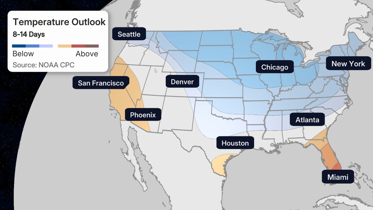
Temperature Swings Over the Weekend
As you travel this weekend, keep in mind that there will be significant temperature swings across the country. Some cities may experience large day-to-day variations.
The Southwest will remain warm, with record highs for this time of year. The South will stay warmer than it has been recently, with a gradual warmup through the weekend in Atlanta.
Temperatures in the North will be more variable. Highs in parts of the upper Midwest could remain in the teens and 20s through the weekend, but with an advancing cold front, places like Chicago will experience a temperature roller coaster through the weekend.
Make sure to check back often, as the forecast is likely to change. We hope you have a wonderful and safe holiday season.
Post a Comment for "Christmas Travel Weather May Be Unpredictable Across Parts of the U.S. Starting Friday: A Sneak Peek"
Post a Comment