NWS Confirms EF-0 Tornado in Lancaster County from Thursday Storms
Overview of the Tornado Event
The National Weather Service (NWS) confirmed that an EF-0 tornado, with maximum winds reaching 70 mph, touched down in the Quarryville area of Lancaster County. This event occurred during a series of thunderstorms that swept through the region around 9:30 p.m. on Thursday, September 4, 2025. The tornado was on the ground for approximately one minute, from 9:31 p.m. to 9:32 p.m., and its path extended for 0.15 miles, with a width of 30 yards.
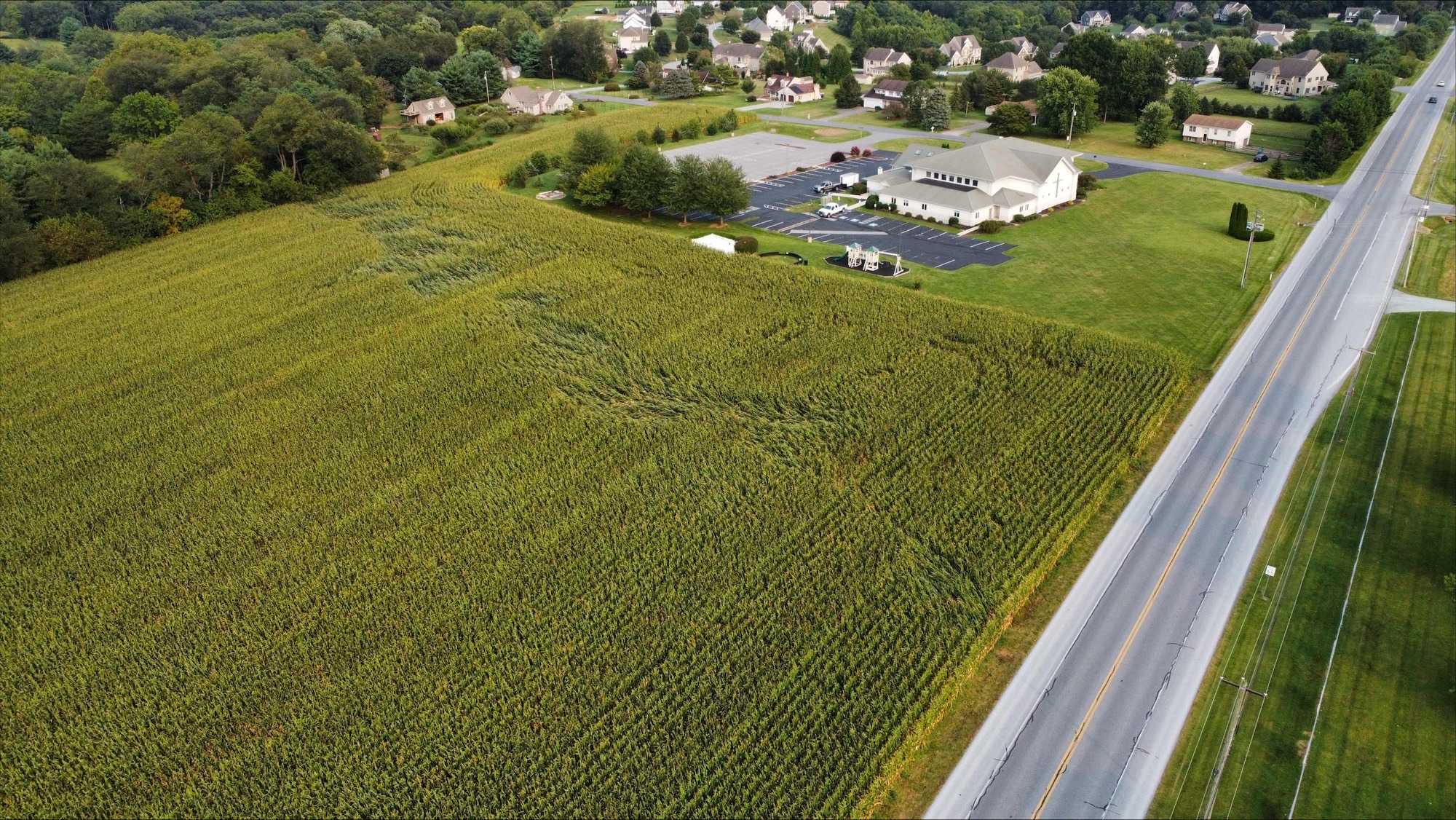
Damage caused by the tornado included a dugout at the Solanco Youth Baseball Association. Following this, the tornado moved into a nearby field, resulting in crop damage. Students from Millersville University's Meteorology program, including Jack Zwolinski, Anthony Haberman, and Adam Daugherty, captured images of the damage, which provided valuable visual documentation of the event.
NWS Damage Survey Details
The NWS issued a public information statement detailing the findings from their damage survey. According to the report, the tornado originated southeast of Collins, Pennsylvania, and lifted off the ground after causing damage to the baseball dugout. It then traveled across Kirkwood Pike, where it affected a field north of Encounter Church. The tornado did not reach a wooded residential area northwest of Hideaway Drive before lifting.
The statement emphasized that the information provided is preliminary and subject to change pending further review and publication in NWS Storm Data. No fatalities or injuries were reported as a result of the tornado.
Understanding the Enhanced Fujita Scale
The Enhanced Fujita (EF) Scale is used to classify tornadoes based on the damage they cause. The scale ranges from EF0 to EF5, with each category corresponding to different wind speeds:
- EF0: 65 to 85 mph
- EF1: 86 to 110 mph
- EF2: 111 to 135 mph
- EF3: 136 to 165 mph
- EF4: 166 to 200 mph
- EF5: Greater than 200 mph
This classification helps meteorologists assess the potential impact of tornadoes and improve forecasting accuracy.
Why There Was No Tornado Warning
One of the most frequently asked questions following the event was why there was no tornado warning issued for the area. The answer lies in the limitations of radar coverage in the Susquehanna Valley. A portion of the valley, including parts of York, Adams, Dauphin, Lebanon, and Lancaster counties, falls within a radar gap.
The NWS relies on five main radar sites located in State College, PA; Fort Dix near Mt. Holly, NJ; Dover Air Force Base, DE; Sterling, VA; and Pittsburgh, PA. These sites are at least 90+ miles away from the southeastern communities in the Valley. As a result, detecting low-level weather phenomena, such as tornadoes, becomes increasingly difficult the farther one is from these radar locations.
Improving Radar Coverage
To address this issue, the WGAL Live Local 8 radar was strategically placed in Millersville, PA, making it the closest live radar to the Valley. This radar system provides more detailed information about low-level weather phenomena, which can help the NWS improve severe weather warning lead times.
On the night of the tornado, data from the Live Local 8 radar indicated signs of rotation and debris in southern Lancaster County. This kind of information is crucial for enhancing the accuracy of weather forecasts and ensuring better preparedness for future events.
Additional News Highlights
In addition to the tornado confirmation, several other stories were covered by local news outlets. These included discussions about water issues in Dauphin County, concerns over home break-ins in Middletown, and student engagement in a mock election in Lancaster. Other reports focused on car thefts in Myerstown and efforts by two Pennsylvania groups to assist those affected by a crash at the Kipona Festival.
For more details on the tornado event and other local news, readers are encouraged to explore the full coverage provided by local media sources.
Post a Comment for "NWS Confirms EF-0 Tornado in Lancaster County from Thursday Storms"
Post a Comment