Plymouth's High-Tech 3D Tree Inventory Initiative
Enhancing Urban Forestry with High-Tech Mapping
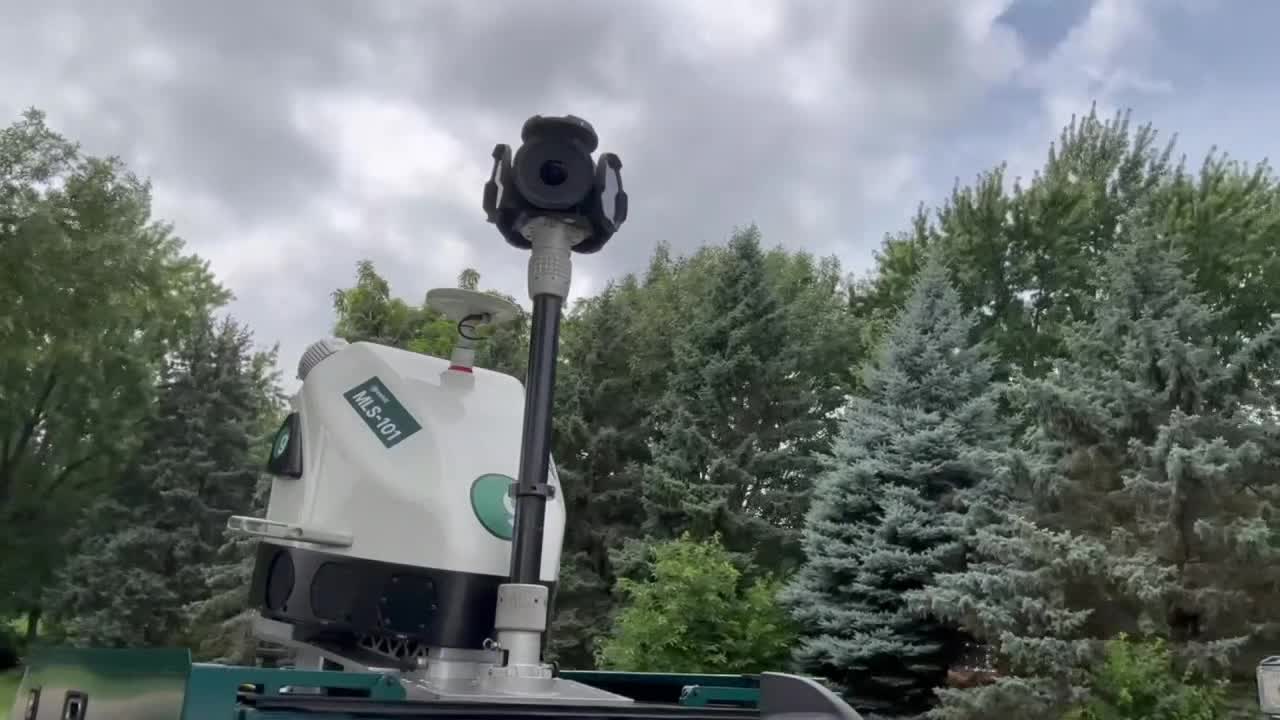
For two weeks, a specially equipped truck has been making its way through every street in Plymouth, while a smaller vehicle has been exploring the city's parks. This initiative is part of an ambitious project to create a detailed 3-D image and searchable map of all trees located on city property. The process involves advanced technology, including cameras and LIDAR systems, combined with artificial intelligence to accurately identify each tree.
This innovative approach aims to provide the city with a more efficient method for managing its urban forest. By identifying trees that require attention—whether due to disease, pests, or overgrowth—Plymouth can focus its resources where they are most needed.
A New Era of Tree Inventory
Plymouth is the first city in Minnesota to implement this high-tech tree inventory system. The city has partnered with two companies, Greehill and Davey Resource Group, to handle the mapping and data processing. According to Paul Buck, the city’s forester, maintaining an accurate tree inventory has always been a challenge.
Traditionally, tree inventories have been created by crews driving around and manually recording information. However, this method often leads to incomplete records, as some trees may be missed or misidentified. This makes it difficult to care for the entire urban forest effectively.
"We’ve had an inventory that we’ve known was incomplete for years," said Buck. "If you want to be efficient, you want to know what you have."
Once the digital mapping is complete, the city will have precise information about the location, condition, and characteristics of each tree. This data will allow them to prioritize which trees need immediate attention based on their size, shape, and overall health.
Advanced Technology for Accurate Data
The scanning process is conducted by Greehill Smart Tree Inventory from Texas, which maps approximately 40 miles of city streets each day. The data collected is then processed by Davey Resource Group using their specialized software system. Jacob McMains, a representative from Davey Resource Group, demonstrated how the system works by showing a map of another city they recently completed.
The software allows users to search the tree inventory in various ways. For instance, selecting a specific species of tree will display how many of that type exist and where they are located. This feature enables the city to quickly identify trends and patterns within the urban forest.
"The power of the data is that it essentially allows you through a bunch of objective metrics to flag trees that look abnormal when compared to the rest of the data set," explained McMains. Additionally, each tree is represented by a 3-D model, which can highlight issues that might otherwise go unnoticed by human inspectors.
"Maybe there’s some die-back in the crown, you can see exactly where that’s located. Maybe there’s some dead wood you want to direct a pruning crew to go and address," added McMains.
A Four-Year Initiative
This project is set to span four years, with a second scan planned in a couple of years. Buck believes this follow-up will serve as a test of the effectiveness of the current approach. By comparing the data from the two scans, the city can determine whether the identified issues have improved over time.
"These are green assets," said Buck. "They’re increasing in value every day they’re here. To ignore them or lose track of them means we’re losing the opportunity to make them better."
By leveraging cutting-edge technology, Plymouth is taking a proactive approach to managing its urban forest. This initiative not only enhances the efficiency of tree care but also ensures that the city's green spaces remain healthy and vibrant for future generations.
Post a Comment for "Plymouth's High-Tech 3D Tree Inventory Initiative"
Post a Comment