Hurricane Erin Triggers Evacuations on North Carolina's Outer Banks Despite Offshore Forecast
Impact of Hurricane Erin on North Carolina’s Outer Banks
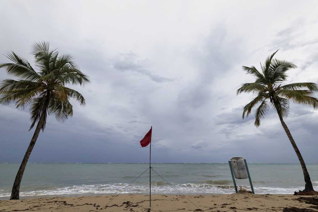
Hurricane Erin has significantly disrupted travel plans for tourists visiting North Carolina’s Outer Banks, despite the storm being expected to remain offshore. The powerful hurricane, which previously caused heavy rain and wind in parts of the Caribbean, has led to evacuations on several barrier islands along the Carolina coast. Authorities have issued warnings about the potential for dangerous rip currents and waves up to 15 feet high that could flood roads.
Tourists and residents found themselves waiting for hours in long lines at Ocracoke Island’s ferry dock, the only way to leave the island besides by plane. Seth Brotherton, a local from Catfish, North Carolina, who had planned a weeklong fishing trip, said he was forced to cut his vacation short. “We definitely thought twice,” he said, adding that the word “mandatory” made it clear he needed to leave.
Despite the storm’s current trajectory, forecasters believe Erin will turn northward and move away from the eastern United States. However, the storm is still expected to strengthen in the coming days, bringing strong waves and tropical-force winds to coastal areas. According to Dave Roberts of the U.S. National Hurricane Center in Miami, the storm has already intensified to a Category 4 with maximum sustained winds of 140 mph. By Monday night, the winds had slightly decreased to 130 mph, with the storm located approximately 695 miles southwest of Bermuda and 805 miles southeast of Cape Hatteras.
In the Turks and Caicos Islands, government officials reported that all services were suspended on three islands, and residents were instructed to stay indoors. On North Carolina’s Outer Banks, coastal flooding is expected to begin on Tuesday and continue through Thursday. Evacuations on Hatteras Island and Ocracoke Island occurred during the peak tourist season, a time when the low-lying barrier islands are particularly vulnerable to storm surges.
A year ago, Hurricane Ernesto, though remaining hundreds of miles offshore, still caused significant coastal damage due to high surf and swells. This time, there are concerns that several days of heavy surf, high winds, and waves could wash out parts of the main highway, according to the National Weather Service. Some routes could become impassable for several days, as authorities warned.
This marks the first time Ocracoke Island has been evacuated since Hurricane Dorian struck in 2019, causing the most severe damage in the island's history. Tommy Hutcherson, owner of the island’s only grocery store, expressed optimism that this storm won’t be as destructive. However, he also acknowledged the uncertainty, recalling how he felt the same way before Dorian and ended up suffering significant damage.
Scientists have linked the rapid intensification of hurricanes in the Atlantic to climate change. Rising global temperatures are leading to warmer ocean waters, which provide more fuel for hurricanes to grow stronger and produce more rainfall. Daniel Pullen, a professional photographer living on Hatteras Island, has already lost three days of work due to the evacuation order. He has chosen not to evacuate, fearing he might be stranded for weeks if Highway 12, the main road, is washed out.
“It’s a bit like Russian roulette,” Pullen said. “Do you stay and take the chance of it hitting you? Or do you leave and take the chance of getting stuck off the island for weeks at a time?” He added that many residents on Hatteras Island cannot afford to stay in a motel for an extended period.
Erin, the first Atlantic hurricane of the year, reached Category 5 status with 160 mph winds before weakening. It is expected to remain a major hurricane into midweek. Richard Pasch of the hurricane center emphasized that Erin is a dangerous storm regardless of its intensity, as it continues to fluctuate.
Bermuda will face the most severe threat from Erin on Thursday evening, with waves potentially reaching 24 feet. Phil Rogers, director of the Bermuda Weather Service, urged caution for anyone planning to go out on the water. Acting Minister of National Security Jache Adams warned that the waters would be extremely dangerous, putting lives at risk.
Before reaching the Outer Banks, Erin’s outer edges brought heavy rains and tropical storm winds to parts of Puerto Rico and the Virgin Islands, causing power outages for thousands. As the storm continues its path, communities across the region remain on high alert, preparing for the potential impacts of this powerful hurricane.
Post a Comment for "Hurricane Erin Triggers Evacuations on North Carolina's Outer Banks Despite Offshore Forecast"
Post a Comment